 GNSS Trait
Overview
The GNSS trait format is used to acquire high-accuracy GPS coordinates from an external, Bluetooth-connected device. While other traits only capture phenotypic or observational data, the GNSS trait is intended to be used to capture metadata about the plot itself. This metadata can be used in conjunction with the  GeoNav feature to automatically navigate through the field.
Creation
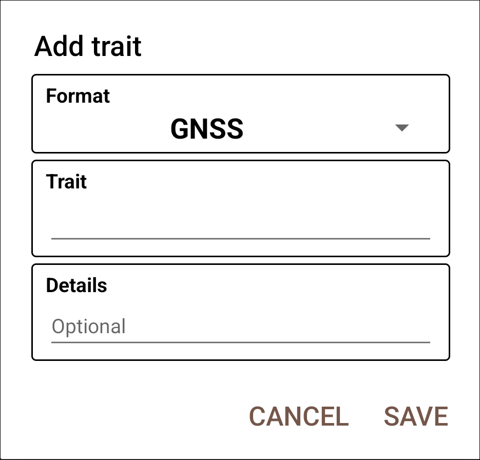
Collect layout
Details
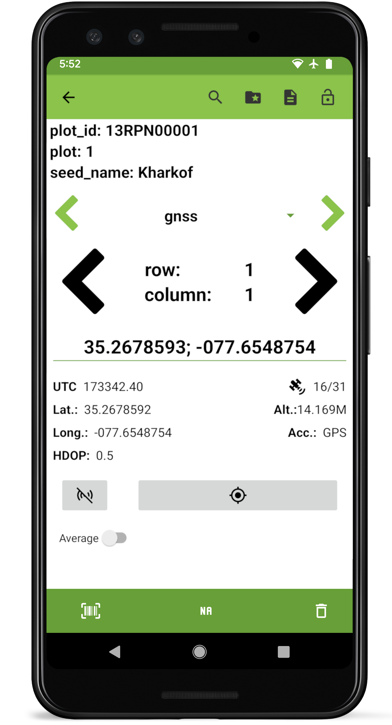
When first navigating to a GNSS trait, the collect screen will show a button that will show a list of devices that can be accessed to provide a location for this trait.
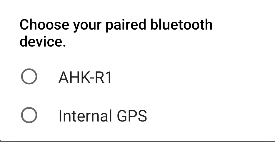
GNSS device select
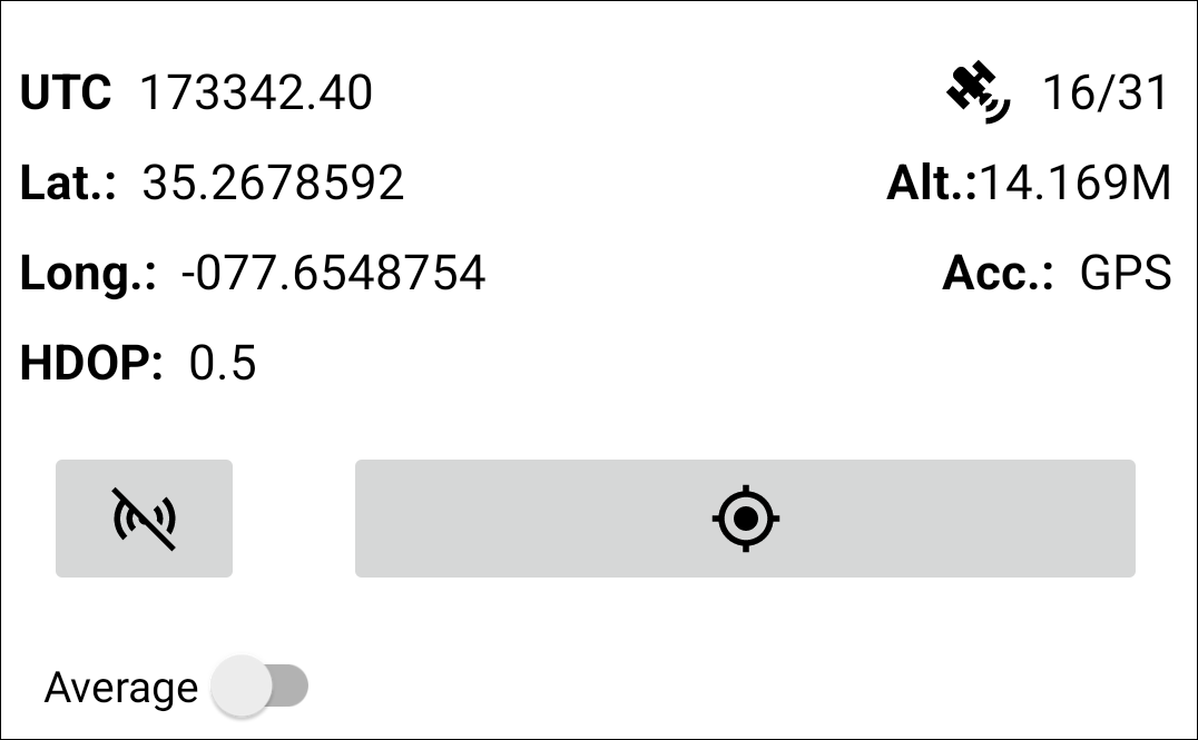
Once a device is selected the screen will populate with a series of values from the GNSS reciever output including high-accuracy latitude and longitude coordinates, current Coordinated Universal Time (UCT), the Horizontal Dilution of Precision (HDOP, a measure of the suitability of satellite positioning in the sky, ideally 1 or below), the number of available satellites, the altitude, and accuracy.
GNSS reciever output
Pressing  will record an instantaneous GPS reading. Toggling the average option will record an average of incoming location data for 5s, 10s, or manually (whereby all manually collected location points are averaged to create a representative value).
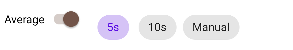
GNSS average options
When recording data for an entry with existing coordinates, a warning message will be displayed to confirm that the existing coordinates will be updated.
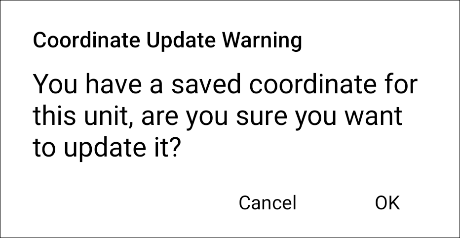
GNSS update warning
If errors occur while collecting gnss data (e.g., socket cannot be established), users may have to manually disconnect/reconnect to the external device.